Geopedology
 -15%
portes grátis
-15%
portes grátis
Geopedology
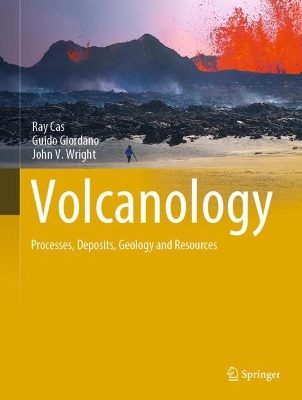
An Integration of Geomorphology and Pedology for Soil and Landscape Studies
Bocco, Gerardo; Zinck, Joseph Alfred; Del Valle, Hector Francisco; Metternicht, Graciela
Springer International Publishing AG
03/2018
556
Mole
Inglês
9783319792668
15 a 20 dias
1170
Descrição não disponível.
Presentation.- Part I: Foundations.- Introduction.- Relations between Geomorphology and Pedology: Brief Review.- The Geopedologic Approach.- The Pedologic Landscape: Organisation of the Soil Material.- The Geomorphic Landscape: Criteria for Classifying Geoforms.- The Geomorphic Landscape: Classification of Geoforms.- The Geomorphic Landscape: the Attributes of the Geoforms.- Part II: Approaches to Soil-landscape Patterns Analysis.- Linking Ethnopedology and Geopedology: a Synergistic Approach.- The Diversity of sSoil-landscape Relationships: State of the Art and Future Challenges.- A New Soil-landscape Approach to the Genesis and Distribution of Typic and Vertic Argiudolls in the Rolling Pampa of Argentina.- Soil-Landform Relationships in the Arid Northern United Arab Emirates.- Knowledge is Power: Where Geopedologic Insights are Necessary for Predictive Digital Soil Mapping.- Geopedology, a Tool for Soil-Geoform Pattern Analysis.- Use of Soil Maps and Surveys toInterpret Soil-Landform Assemblages and Soil-Landscape Evolution.- Part III: Methods and Techniques.- Soil Survey Based on Landscape Classification in an Area of Semiarid Chaco Ecosystem, Argentina.- Updating of a Physiographically-Based Soil Map Using Digital Soil Mapping Techniques.- Contribution of Open Access Global SAR Mosaics to Soil Survey Programs at Regional Level: A Case Study in North-Eastern Patagonia.- Geopedology Promotes Precision and Efficiency in Soil Mapping. Photo-interpret
ation Application in the Henares River Valley, Spain.- Using Geomorphometry to Map
Physiographic units in Colombia.- Geomorphometric Landscape Analysis of Agricultural Areas and Rangelands of Western Australia.- Multi-scale Application of a Hierarchic Geomorphic System in Soil Survey in Colombia.- Digital Elevation Models to Improve Soil Mapping in Mountainous Areas: Case Study in Colombia.- Landform Mapping in Somalia Using SHILMA (Somalia Hierarchical Integrated Landform Mapping Approach).- The Outcomes of Applying a Geopedologic Approach to Soil Survey in Iran.- The role of Geopedology in Mapping Soils in Thailand.-Neuro-fuzzy Classification of the Landscape for Soil Mapping in the Central Plains of Venezuela.- Part IV: Applications in Land Degradation and Geohazard Studies.- Gully Erosion Analysis. Why geopedology matters?.- Soil Susceptibility to Mass Movements: A Geopedologic Approach.- Geomorphic Landscape Approach for Mapping Soil Degradation and Hazard Prediction in Semi-arid Environments: A Case Study of the Cochabamba Valley (Bolivia).- Geopedology and Land Degradation in Northwest Argentina.- Adequacy Of Soil Information Resulting from Geopedology-based Predictive Soil Mapping for Assessing Land Degradation: Case Studies of Nam Chun, Pa Sak Valley and Nong Sung in Thailand.- Part V: Applications in Land Use Planning and Land Zoning Studies.- Implementation of a Geopedologic Map as a Basis for Delineating Ecosystem Units at National Level in Colombia.-Ecological Land Zonation Using Integrated Geopedologic and Vegetation Information. Case Study of the Cabo de Gata-Nijar Natural Park (Almeria, Spain).- Soil Survey Applying the Geopedologic Approach in Argentine North Patagonia as Basic Information to Design a Forestry Plan.- Territorial Zoning Based on Geopedologic Information: Case Study in the Caroni River Basin, Venezuela.- Contribution of Geopedology to Land Use Conflict Analysis and Land Use Planning in a Peri-urban Fringe.- Applying a Geopedologic Approach for Mapping Tropical Forest Soils and Related Soil Fertility in Northern Thailand.- Synthesis and Conclusions.
Este título pertence ao(s) assunto(s) indicados(s). Para ver outros títulos clique no assunto desejado.
Environmental management;Geomorphology;Landscape and regional planning;Remote sensing;Soil science and conservation
Presentation.- Part I: Foundations.- Introduction.- Relations between Geomorphology and Pedology: Brief Review.- The Geopedologic Approach.- The Pedologic Landscape: Organisation of the Soil Material.- The Geomorphic Landscape: Criteria for Classifying Geoforms.- The Geomorphic Landscape: Classification of Geoforms.- The Geomorphic Landscape: the Attributes of the Geoforms.- Part II: Approaches to Soil-landscape Patterns Analysis.- Linking Ethnopedology and Geopedology: a Synergistic Approach.- The Diversity of sSoil-landscape Relationships: State of the Art and Future Challenges.- A New Soil-landscape Approach to the Genesis and Distribution of Typic and Vertic Argiudolls in the Rolling Pampa of Argentina.- Soil-Landform Relationships in the Arid Northern United Arab Emirates.- Knowledge is Power: Where Geopedologic Insights are Necessary for Predictive Digital Soil Mapping.- Geopedology, a Tool for Soil-Geoform Pattern Analysis.- Use of Soil Maps and Surveys toInterpret Soil-Landform Assemblages and Soil-Landscape Evolution.- Part III: Methods and Techniques.- Soil Survey Based on Landscape Classification in an Area of Semiarid Chaco Ecosystem, Argentina.- Updating of a Physiographically-Based Soil Map Using Digital Soil Mapping Techniques.- Contribution of Open Access Global SAR Mosaics to Soil Survey Programs at Regional Level: A Case Study in North-Eastern Patagonia.- Geopedology Promotes Precision and Efficiency in Soil Mapping. Photo-interpret
ation Application in the Henares River Valley, Spain.- Using Geomorphometry to Map
Physiographic units in Colombia.- Geomorphometric Landscape Analysis of Agricultural Areas and Rangelands of Western Australia.- Multi-scale Application of a Hierarchic Geomorphic System in Soil Survey in Colombia.- Digital Elevation Models to Improve Soil Mapping in Mountainous Areas: Case Study in Colombia.- Landform Mapping in Somalia Using SHILMA (Somalia Hierarchical Integrated Landform Mapping Approach).- The Outcomes of Applying a Geopedologic Approach to Soil Survey in Iran.- The role of Geopedology in Mapping Soils in Thailand.-Neuro-fuzzy Classification of the Landscape for Soil Mapping in the Central Plains of Venezuela.- Part IV: Applications in Land Degradation and Geohazard Studies.- Gully Erosion Analysis. Why geopedology matters?.- Soil Susceptibility to Mass Movements: A Geopedologic Approach.- Geomorphic Landscape Approach for Mapping Soil Degradation and Hazard Prediction in Semi-arid Environments: A Case Study of the Cochabamba Valley (Bolivia).- Geopedology and Land Degradation in Northwest Argentina.- Adequacy Of Soil Information Resulting from Geopedology-based Predictive Soil Mapping for Assessing Land Degradation: Case Studies of Nam Chun, Pa Sak Valley and Nong Sung in Thailand.- Part V: Applications in Land Use Planning and Land Zoning Studies.- Implementation of a Geopedologic Map as a Basis for Delineating Ecosystem Units at National Level in Colombia.-Ecological Land Zonation Using Integrated Geopedologic and Vegetation Information. Case Study of the Cabo de Gata-Nijar Natural Park (Almeria, Spain).- Soil Survey Applying the Geopedologic Approach in Argentine North Patagonia as Basic Information to Design a Forestry Plan.- Territorial Zoning Based on Geopedologic Information: Case Study in the Caroni River Basin, Venezuela.- Contribution of Geopedology to Land Use Conflict Analysis and Land Use Planning in a Peri-urban Fringe.- Applying a Geopedologic Approach for Mapping Tropical Forest Soils and Related Soil Fertility in Northern Thailand.- Synthesis and Conclusions.
ation Application in the Henares River Valley, Spain.- Using Geomorphometry to Map
Physiographic units in Colombia.- Geomorphometric Landscape Analysis of Agricultural Areas and Rangelands of Western Australia.- Multi-scale Application of a Hierarchic Geomorphic System in Soil Survey in Colombia.- Digital Elevation Models to Improve Soil Mapping in Mountainous Areas: Case Study in Colombia.- Landform Mapping in Somalia Using SHILMA (Somalia Hierarchical Integrated Landform Mapping Approach).- The Outcomes of Applying a Geopedologic Approach to Soil Survey in Iran.- The role of Geopedology in Mapping Soils in Thailand.-Neuro-fuzzy Classification of the Landscape for Soil Mapping in the Central Plains of Venezuela.- Part IV: Applications in Land Degradation and Geohazard Studies.- Gully Erosion Analysis. Why geopedology matters?.- Soil Susceptibility to Mass Movements: A Geopedologic Approach.- Geomorphic Landscape Approach for Mapping Soil Degradation and Hazard Prediction in Semi-arid Environments: A Case Study of the Cochabamba Valley (Bolivia).- Geopedology and Land Degradation in Northwest Argentina.- Adequacy Of Soil Information Resulting from Geopedology-based Predictive Soil Mapping for Assessing Land Degradation: Case Studies of Nam Chun, Pa Sak Valley and Nong Sung in Thailand.- Part V: Applications in Land Use Planning and Land Zoning Studies.- Implementation of a Geopedologic Map as a Basis for Delineating Ecosystem Units at National Level in Colombia.-Ecological Land Zonation Using Integrated Geopedologic and Vegetation Information. Case Study of the Cabo de Gata-Nijar Natural Park (Almeria, Spain).- Soil Survey Applying the Geopedologic Approach in Argentine North Patagonia as Basic Information to Design a Forestry Plan.- Territorial Zoning Based on Geopedologic Information: Case Study in the Caroni River Basin, Venezuela.- Contribution of Geopedology to Land Use Conflict Analysis and Land Use Planning in a Peri-urban Fringe.- Applying a Geopedologic Approach for Mapping Tropical Forest Soils and Related Soil Fertility in Northern Thailand.- Synthesis and Conclusions.
Este título pertence ao(s) assunto(s) indicados(s). Para ver outros títulos clique no assunto desejado.